The internet makes it SO easy to plan a trip, especially when you Plan a Road Trip with Google Maps. Let me show you how I do it.
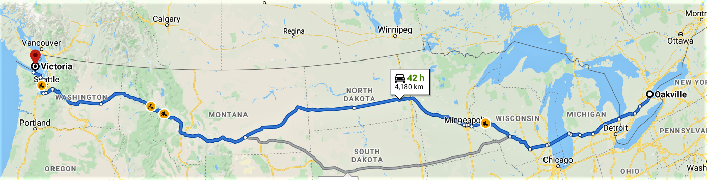
First, I identify the main road that I will be travelling on to get to the final destination. In this case, the shortest route is to travel through the USA, but for this particular trip we want to stay in Canada.
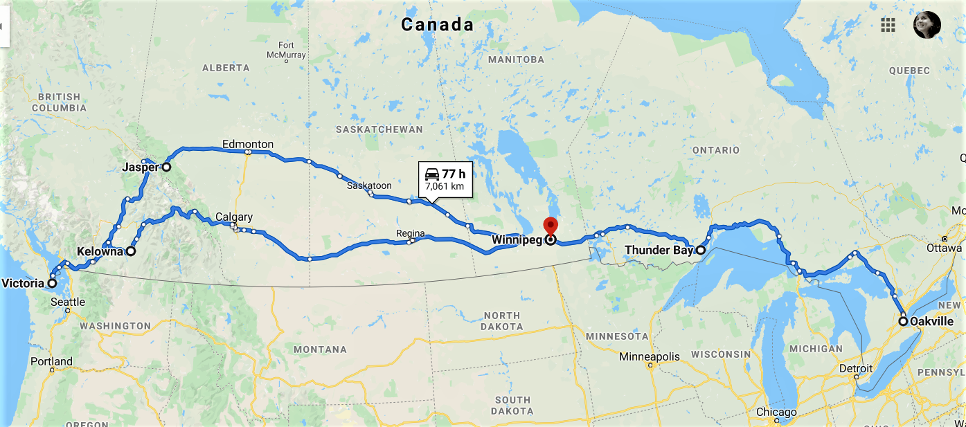
I add a couple of stops that I know I want to pass through (Winnipeg, Jasper & Kelowna), and now I have a general route.
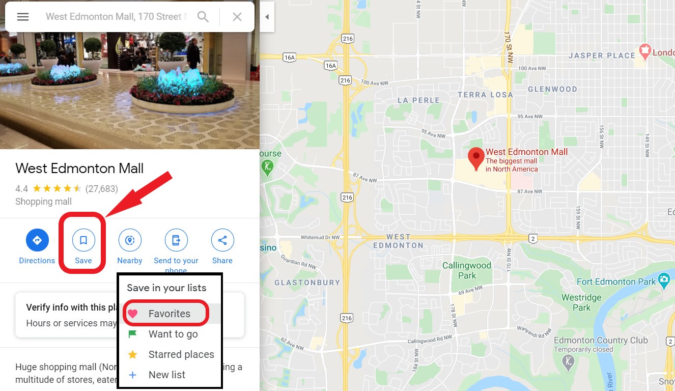
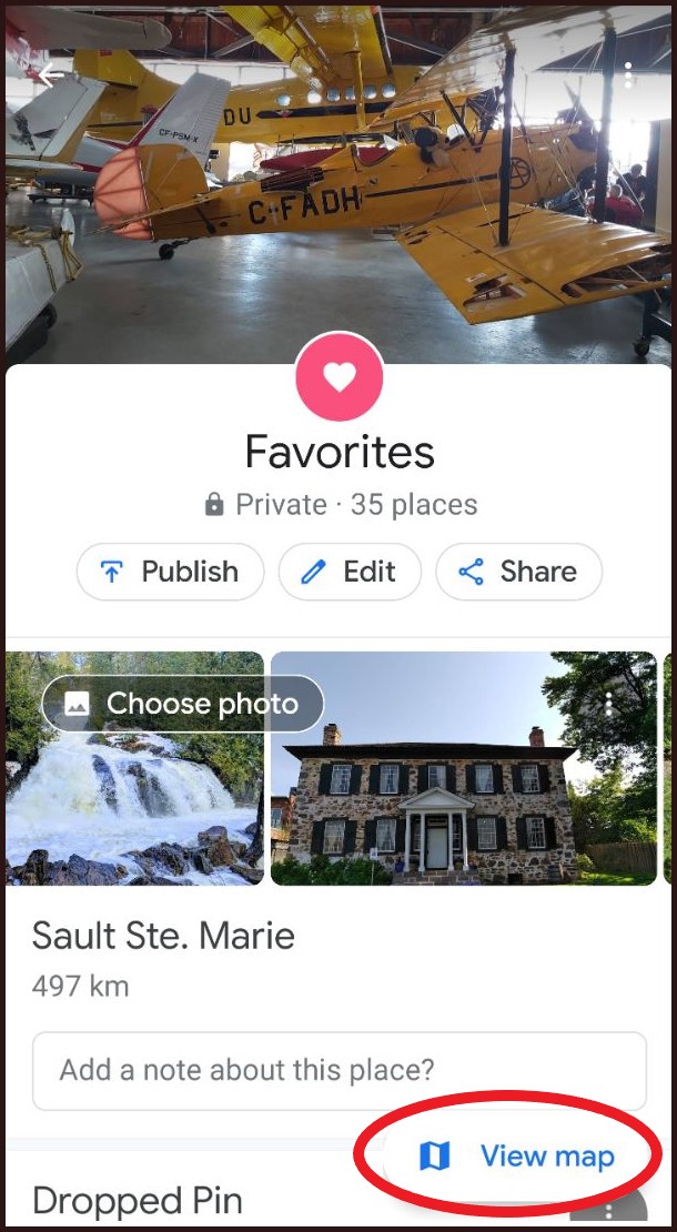
Then I take an area at a time and identify the places that I’ve always wanted to visit, as well as places recommended by travel sites. For example, if I’m passing through Edmonton and I would like to visit the West Edmonton Mall, I search for it in Google Maps, click on “Save” and choose the Favorites list.
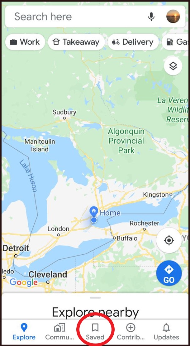
After I identify all the places I’d like to visit, I can view all my Favourite spots on the map. I simply click on the Google Maps Menu (top left), Select ‘Your places’, then click ‘SAVED’, then click ‘Favorites’.
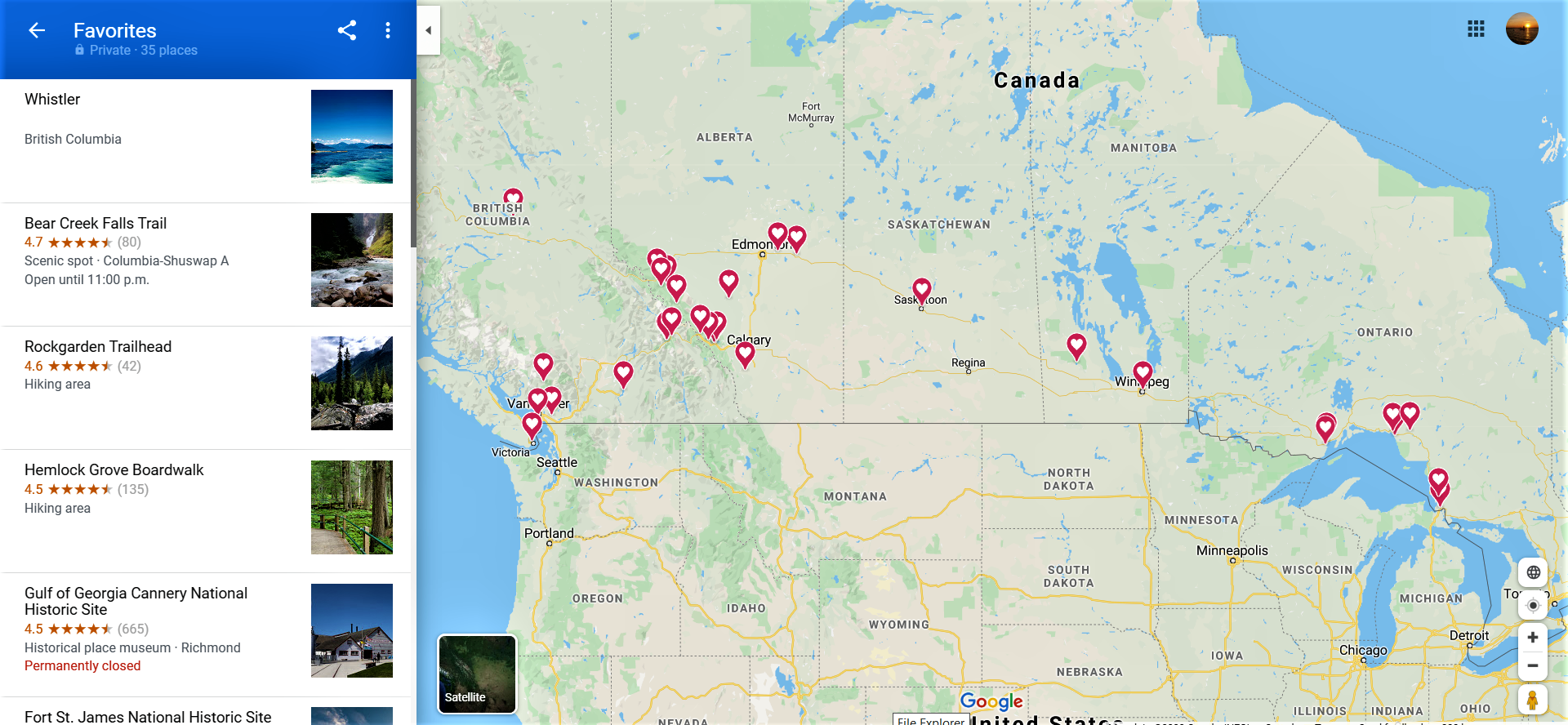
Now I have a big picture of what my trip will look like. I can adjust the route based on my favourite places that I identified. For example, I would love to visit Whistler, BC. My original road plan didn’t pass by there, so I will adjust the plan to drive a little more north in BC to visit.
Plan a Road Trip with Google Maps
If you have the Google Maps app on your smartphone, you can also view all your favourites there. All phone display the app a little differently, but if you can find ‘Saved’, and ‘Favorites’, you can view them by List, or by Map. This is very helpful when you’re travelling.


And that’s how I do it. As you can see from the screenshots above, I’m currently planning a trip to Western Canada. I’m always looking for secret hidden gems to visit – if you know of any, let me know! Thanks for reading!
Yours Truly …. Yula


